Please Sponsor Me

JustGiving - Sponsor me now!

Friday, 19 July 2013

Day 07 - All Creatures Great and Small

Malham to Horton in Ribblesdale

Today's Miles - 15.2
Today's Ascent - 3959
Today's Descent - 3884
Total Miles so Far - 98.4
Star Team Member -  Mam for washing out all of our sweaty clothes in the hotel sink! Not a nice job!

Today we walked with Petra, our German friend, as she was sharing a taxi with us back to Malham, as she too was unable to find accommodation In Horton in Ribblesdale. We set off at nine o'clock after a hearty breakfast, and walked out of the village up to Malham Cove.

Walking up to Malham Cove
Having studied Malham in Geography, I understand how many of Malhams main limestone features are formed, but you don't want to know about that, do you? No, I can tell that you don't. We walked up the paving slab steps up to the top (I happen to know this is local stone, airlifted form Skipton, but you don't want to know about all that, do you?!)

Steps up to the top of Malham Cove

Having reached the top we could see the limestone pavements. If you are a Harry Potter fan, like me, do you remember seeing Harry camp in Deathly Hallows Part 2, on the limestone pavements? Well this was on these exact same pavements we had walked along! Cool, right?!


Limestone Pavements 

Of course, I had to do a bit of a re-enactment! (Walking pole is acting as a temporary wand- use your imagination!)

Potter le Mad

From the pavements it was a short drop down to Malham Tarn, where we passed some cows, once again! We threw some stones fro Paddy into the tarn, more like a lake really, and walked up to a field centre and they kindly filled up our water bottles. 

Malham  Tarn
Walked through some nice shaded woodland and passed a big metal spider, certainly unusual Pennine wildlife.  

More Pennine Wildlife

From here we started to climb upwards to a hill called Fountains Fell. We had a few sherbet lemons and continued on up. I got a text from both Uncle Paul and uncle Gerard, giving me support. I was looking forward to my lunch of a croissant (probably squashed) and some warm water. They both kindly reminded me that they were out in Colemans, South Shields, having fish and chips. I'm not bitter!

I got to the top to find my croissant, as I predicted squashed, but still edible, and we stopped for a break and lunch.

Top of Fountains Fell

we could see the challenge ahead of us; Pen-y-ghent, the smallest mountain on the Yorkshire walk, the Three Peaks. It looked quite steep and we were feeling a bit apprehensive, and Petra and I thought that the short cut was a good idea! But we plodded on! We walked down to the road and I did a bit of frolicking through the grass. Live while your're young! (and have the knees to frolic!)  

Daunting; Pen - Y - Ghent

We walked along the road and turned off at a farm to begin the descent up the big one. It wasn't as steep as it looked from Fountains Fell, but it was still very hard. We did a bit of scrambling up some rocks and the top was there! We congratulated ourselves with another sherbet lemon, and with three miles to go, pressed onwards. Mam wants me to say that the seat at the top had some interesting fossils (I thought they were a bit boring!), so to keep her happy I put that in. 

The Summit of Pen - y - Ghent

From here we took a path down that took us to a road. It was quite steep to begin with, but when we reached the road it flattened out. From the road we slowly mi-anded into the small village of Horton in Rinnlesdale. We picked up the only road running through the village, passing the church to reach the pub. After a drink and a packet of bacon fries, our taxi arrived to take us back to Malham. Paddy had a luxury fleecy blanket in the boot so was very pleased; he only travels 1st Class you know!
Church at Horton in Ribblesdale  (Pen - y - Ghent in the background)
It was a bit off-putting driving backer in the taxi. It took us 9 hours to walk form Malham to Horton, but only 19 minutes driving back. We kept telling ourselves that the distance was shorter and the taxi didn't go over Pen-y-ghent on the way!

Thank you for reading this post, I hope you enjoyed it. See you tomorrow in Hawes!

Caitlin x 

xxx

Thursday, 18 July 2013

Day 06 - Moo-ving On

Thornton in Craven to Malham

Today's Miles - 11.5

Today's Ascent - 2178

Today's Descent - 1902

Total Miles so Far - 83.2 

Star Team Member - Everyone, for their fabulous effort in handling the four legged milk producers. 

Today was our shortest day so far, but don't get me wrong it was still quite a way! It was really hot, but I am sure you will be pleased to know that this time there was en route refreshments; I think it was well deserved, after a bit of a pub shortage. Unfortunately Thornton in Craven had no chocolate shops, as it suggests in the name, but we did have some boiled sweets from the hotel reception. Pockets loaded with small boiled sweets (they were complimentary okay?) we set off on Day 06....

We walked out of our hotel and into some lush green fields to try and pick up the Pennine Way footpath again. Paddy scouted ahead, as per usual, through the long grass and we came to a road.

Walking out of Thornton in Craven


We crossed the road and dropped down to a canal. This canal joined Leeds to Liverpool, reminding us that yes, we were near(ish) civilisation. We walked along the canal and turned into some fields where we had our first break. After our break we made our way to the village of Gargrave, 2.5 miles from where we had stopped. 


Leeds - Liverpool Canal
We walked through lots of fields really, until we got to the village, to find the pub open (thankfully!). I had 2 lemonades and some crisps and nuts and gave my Grandma a ring (hello by the way, Grandad sorry I missed you!).  We passed the church and continued onwards....

Church at Gargrave

We stopped off at a sweet shop to stock up on supplies, and with 6 miles to go, we were feeling we had broken the back of the walk. Dad went to try and find Paddy a river to dunk him in as it was getting very hot for him. He gave Mam and I the SatMap and told us to go straight on. So we did. 15 minutes later we heard a bellow echo through the dales. We had gone the wrong way. We rejoined Dad on the correct path and continued onwards.

Back over the canal

This is really when our animal troubles began. first we couldn't find the path, but we soon sorted that out. The path took us through a big field of cows, and as I explained yesterday cows and dogs don't get on. We used our usual method, and with Dad and Pads walking down through to the end of the field, the herd was following them, but at a slow pace. A passing couple helpfully told us 3 ladies near where they lived had been trampled on. Really helpful. With nothing to see any more they turned their attention to Mam and I. The started walking towards us, but luckily there was a gate we slipped through. Dad gave me a ring and told me to scare them away by standing on the gate, waving my arms and bellowing. What a sight I must have been! Help factor: 0. They got a bit angry but we were safe on the other side but had no way to get to Dad and Paddy. In the end we had to climb over the dry stone wall and barbed wire and walk to the road where we met the rest of the team. Stressful!

We had a well deserved rest and continued onwards. We had another cow dilemma, but with unhelpful input from some horses too, but finally we reached a road taking us to a little village called Airton.

Wild Beasts of the Pennines

You are not going to believe it but we had ANOTHER cow problem. We walked through the field and as some cows were following Dad and Paddy in one field, Dad slipped into the other, where he was greeted by another herd of cows. Hurrah! We power-walked for Britain until we got to the safety of another road that took us to Airton.

Airton


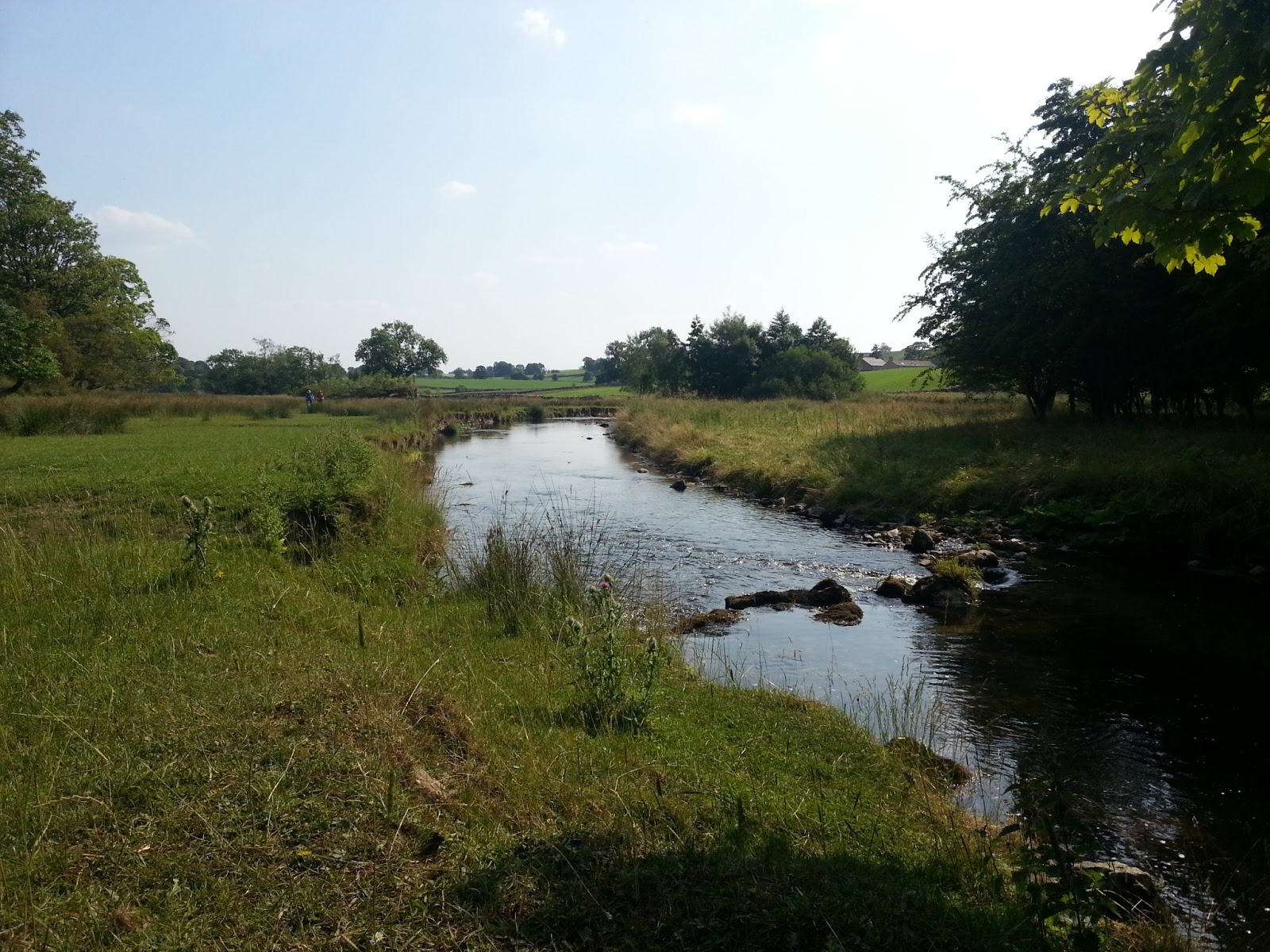
Passing through Airton, we stopped for a rest by the river with two miles to go, and I through some stones for Paddy. With 2 miles to go we marched on through the fields (more cows- this time less unfriendly) that took us to Malham.

River Aire on the way to Malham


We reached the village, and having been here on Geography fieldwork before I roughly know my way around so we found the hotel quickly, where a meal with Petra (the German lady we have met along the way) followed, and now I am most definitely ready for bed.

Thank you for reading this post. Tomorrow up and over Pen-y-ghent to Horton in Ribblesdale; see you then!

Caitlin :-)

Wednesday, 17 July 2013

Day 05 - Up Hill and Down Dale

Haworth to Thornton in Craven

Today's miles -13.3
Today's Ascent - 2959
Today's Descent - 3254
Total Miles so Far -71.7
Star Team Member - Caitlin & Mam, for their excellent singing of ABBA classics to keep spirits up*. Oh, and we will throw Pads in there too.


* I have deliberately NOT given Star Team Member to Sherpa Dad, as he already presumes he is Star Team Member. So there! 

I have just had a text from my Grandad to say he can not wait for my blog to be published, so for the sake of his sore index finger (continuously pressing the refresh button on this page) I will begin...

Today was a bit of a let down really. Dad promised us only 8 miles but we ended us doing 12.8, because he 'miscalculated'. Rest assured, dear blog reader, both Mam and I told him how upset and disappointed we were with him. Nevertheless, ever willing we continued out of Haworth, to start Day 5....

We walked along the road and passed a reservoir on the left (I have noticed, Yorkshire likes it's reservoirs!) We turned off the road and climbed a big hill out of Haworth towards Cowling.   
Climbing Out of Haworth


We passed a large rusty tractor on the way upwards and Dad took my picture (a great excuse for a break too!). We continued to climb upwards until we reached the top. But as I always say, for every uphill, there must be a downhill. So, we slowly descended into village No 1, Cowling. Dad's SatMap said the village had a pub, and it was about 12:30, so this was a perfect lunch stop.
Which way is Kirk Yelthom?

Upon reaching Cowling, we found the pub had closed three weeks ago and that there wasn't a village shop or even a bench to sit on. I think it is fair to say that Cowling was a major let down.

We walked out of Cowling and stopped in a field for our break. Mam rubbed her feet and I had an oat bar, a bit dissapointing after the promised chips and diet coke, but oh well! We walked along by a beck but could find no way for Paddy to get in it, but I scouted ahead and found a steep thorny way to get down. Pads had a splash and we proceeded onwards.

We got to a field with some cows in, and as you probably know, dogs and cows aren't the best of friends. Here is my guide, which is practically foolproof and always works to avoiding these nasty clashes. This is what we do;

Caitlin's Guide to avoiding Cow/Dog clashes
1) Send a (un)willing person through the field (in our case Dad, or as we call him in these sticky situations, Farmer Giles.) Get a stick to lengthen their arm and make them herd the cows away from the path.

2) Keep your vulnerable dog hidden (behind wall, bush, fence, etc...)

3) once the coast is clear, get the cow herder at the other end of the field to yell your dogs name, then the person at the gate lets the dog off and it runs very fast through the field.

Hey presto! Safe and happy dog and bemused cows.

Easy Navigation

Paddy successfully through the field, we continued on. I realised that I had left my sunglasses somewhere and walked back. I couldn't find them so Dad went all the way back, with me to where we had our break. We eventually found them where I had let him in the stream.
Mam went onwards, but only got about 1/4 of a mile because she got lost.

Keep Following the PW Signs Mam!
We dropped down in to village No 2, Lothersdale, where there was also a pub- hurrah! Chips and coke at last. When we reached the pub it was closed and the sun continued to beam down. We bitterly thought what could have been, but we stopped at one of the houses and they filled our water bottle up though.

Lothersdale (pub shut)

Water bottle full we began to climb the last hill of the day in the baking heat. We got to the top and began to descend down to the final destination. Dad went ahead with Pads to find a stream, while Mam and I made our way down singing an ABBA medley, keeping spirits high.

Last Hill of the Day

We reached the village in the hot sun worn out and tired, to find the nice man from the hotel had come to pick us up, as there was no available accommodation for the night in Thornton in Craven.

Overall a good day in the baking hot sun. Tomorrow we go to Malham- see you then!

Caitlin x
N.B I would just like to say a big congratulations to my amazing sister who has just been promoted to a 2nd lieutenant Officer in the Cadets. Well done!


Tuesday, 16 July 2013

Day 04 - Wuthering Feet in the Hot Eyre!

Hebden Bridge to Haworth

Today's miles - 12.7

Today's Ascent - 2933 feet

Today's Descent - 2516 feet

Total Miles so far - 58.4

Star Team Member: Sherpa Dad for detouring to bring us cold drinks.


Today was really enjoyable, if a bit too hot! It it funny, when I am walking all I want is for the sun to come out, and when it does, I complain that it is too hot! We left the lovely little town of Hebden Bridge at about 10 o'clock, to set off for Bronte Country.

We walked along the canal, with its queer boats and many locks, in the hot sun. Paddy had a splash in the water before we turned right to cross the road and start the uphill climb out of the valley.
Walking along the canal at Hebden Bridge

The path ascended steeply upwards through ferns and nettles; it was like a jungle. Both Mam and Dad got stung by the tall nettles (another couple of injuries to add to our long list!), and I was lucky not to get stung. My walking stick acted as sort of a machete, pinning back the long weeds and grass. We plodded onwards to reach a mini valley and I went ahead with Paddy to cool him down in the river, while Sherpa Dad and Organiser Mam took their time down the steps to the river.

Cooling down at Colden

After our rest at Colden we continued onwards. We saw a sign for 'May's Aladdin's Cave' selling cold drinks. We managed to persuade Dad to go and get us some, while Mam and I walked ahead. Cloudy lemonade, Diet Coke and Ribena were greatly appreciated in the baking hot sun!
A much needed cold drink!


We walked down to a river where we stopped for our lunch, a very nutrition, strawberries and chocolate, from Hebden Bridge Co-op. We made Pads go in the stream as it was hot and we knew he would appreciate it afterwards. I took off my boots and cooled my feet off in the river, that was lovely.

We walked onwards after lunch (you could call it that!) towards some reservoirs. We got Lower Walshaw Reservoir to find all the water had been drained and it was empty, but continuing on to Upper Walshaw it was full and clean and Paddy was more than happy to swim about in it.

We climbed up to the top of Withins Height, on the way passing some diggers laying down some handy limestone paving slabs.

On top of Withins Height

At the top of the hill there were some ruins of an old farm, that were supposedly the base for Emily Bronte's famous book, Wuthering Heights. Haworh was only a couple of miles away, and we passed lots of tourists following the Bronte trail, with signs pointing the way in both English and Japanese!

From here it was an easy stroll down to our accommodation for the night, just outside Haworth.

I have to say, it was a bit strange walking through Bronte country in the sun! Throughout the books the Bronte's describe the moors as dark and mysterious, but in the sun they looked beautiful, and the total opposite as described in the books.
Walking down to Haworth

Dad has just broken the news that tomorrow is actually 12 miles, not the promised mere 8 that Mam and I were looking forward to, so I better take my lead from Paddy (who has been in a deep sleep from 6 o'clock onwards) and head to bed. I don't have the energy to tell Dad he has let us down and that I am not too pleased with him as he has continuously said to Mam and I "Get through the first 4 days and then there is an easy 8 miler", but rest assured he will know tomorrow.

Highlight of the day: Sitting by the river in the sun eating strawberries and choc.

Thank you for reading this post, see you tomorrow,

A very tired Caitlin, and dog in deep sleep :-) 


Monday, 15 July 2013

Day 03: Flat Out .... No Hills Today

Standedge to Hebden Bridge

Today's miles - 16.2

Today's Ascent - 2493 feet

Today's Descent - 3162 feet

Total miles so far - 45.7

Star team member: Caitlin and Paddy, for setting a fantastic stride towards the latter end of the journey. 

Today was a long day but a lot easier,  and as Grandad kindly told me 'no hills today'. He was mainly right, however there were a few small ones to climb,  but nothing compared to the two previous days. 

We walked back from the B &B to pick up the Pennine Way again. We climbed a small hill to gain some hight.  Once on the top we walked along Blackstone Edge quickly and soon had done four miles.


Blackstone Edge

We then crossed the busy M62, using the footbridge high above the traffic. All the traffic whizzing underneath was a little scary.

Above the M62


We walked up a small hill and reached the top, before following a small path that soon fizzled out to nothing. I asked Dad where the path was and he said there was no path. After a bit of traversing we managed to find the proper path and walked down to the White House pub for lunch where we met Petra a German lady who is also doing the Pennine Way.

After the pub we walked along a path that took us along several reservoirs. 

Otter Dog

We walked along at a steady pace, in the distance we could see the Stoodley Pike Monument which never seemed to get any closer.


Stoodley Pike in the distance


We walked along the paving stone path (our favourite) and eventually reached the monument.

We made it


From the monument to Hebden Bridge it was a bit complicated as Mam's knees were really hurting and the last thing they needed was a steep descent. Our hotel was right at the bottom of Hebden Bridge and we detoured off the Pennine Way down a really steep hill.

Hebden Bridge

Mam's knees were really hurting but we sang Sound of Music songs to help take her mind off the pain. We could see Hebden Bridge and it was just a matter of time before we arrived. Sherpa Dad stopped at the Co-Op to get Pads his tea and we met Cousin Mandy and Uncle Chris for a brilliant meal.

Tomorrow we go to Howarth, see you all then.

Highlight of the day: Meal with Mandy and Uncle Chris.


Sunday, 14 July 2013

Day 02: Everybody Hurts!

Crowden to Standedge 

Today's miles  - 13.4 miles
Today's Ascent - 3024 feet
Today's Descent - 2647 feet
Total miles walked so far: 29.5

Star team member: Dad for carrying our endless toiletries in his coffin like backpack, and only complaining twice!

Today Team Pennine Way were aching everywhere! Dad's shoulders were hurting from carrying the coffin, Mam's knees were aching, and I was hurting everywhere....

We set off from Crowden through some fields, across the damn and through a nice shaded wood. Paddy liked this as he had a break form the hot sun.

A cool start to the day


We started to climb uphill through fields, but soon reached a clear uphill path. There were lots of streams for Paddy to drink, and we kept going upwards fro about an hour and a half. We reached the top of the first climb and were greeted by a wonderful view, looking back on the route we had come.

A good start


There were some rocky crags on the right had side of the path and a steep drop, so we were careful where we put our feet. The path started to descend and levelled out and soon we had a quick pace, moving along. There was a fell race on, so we had to keep stopping to let the fell runners pass.

We stopped after a stile and had our lunch, watching the runners, while we ate. We moved on upwards after lunch to start ascending a hill, but the gradient was not very steep, but it was a long way to the top. The hill was called Black Hill, because of the bog and peat, but we were ok, as we walked along the paving slabs. At the top of the hill we thankfull parted with the fell runners who headed off to their finish line. Mam and I share a flake. Yum!

The top of Black Hill

We proceeded to descend the hill, but it was very steep and Mam's knees were aching, so it took us quite a long time. The path turned and flattened out, and we could see a main road.we ad five miles to go! Once again, Mam and I thought we could see an ice cream van (we are easily fooled), but when we got there, it turned out to be a Police van. Let down again!

We crossed over and had our first Thomas Traverse. Dad took us through some heather, on no apparent path, he still insists there was one now, (?) but we soon reached a proper path, clearly the right way. It was flat so we got going along the Wessenden Valley, and stopped at the four mile mark to look at the near empty reservoirs.

Wessenden


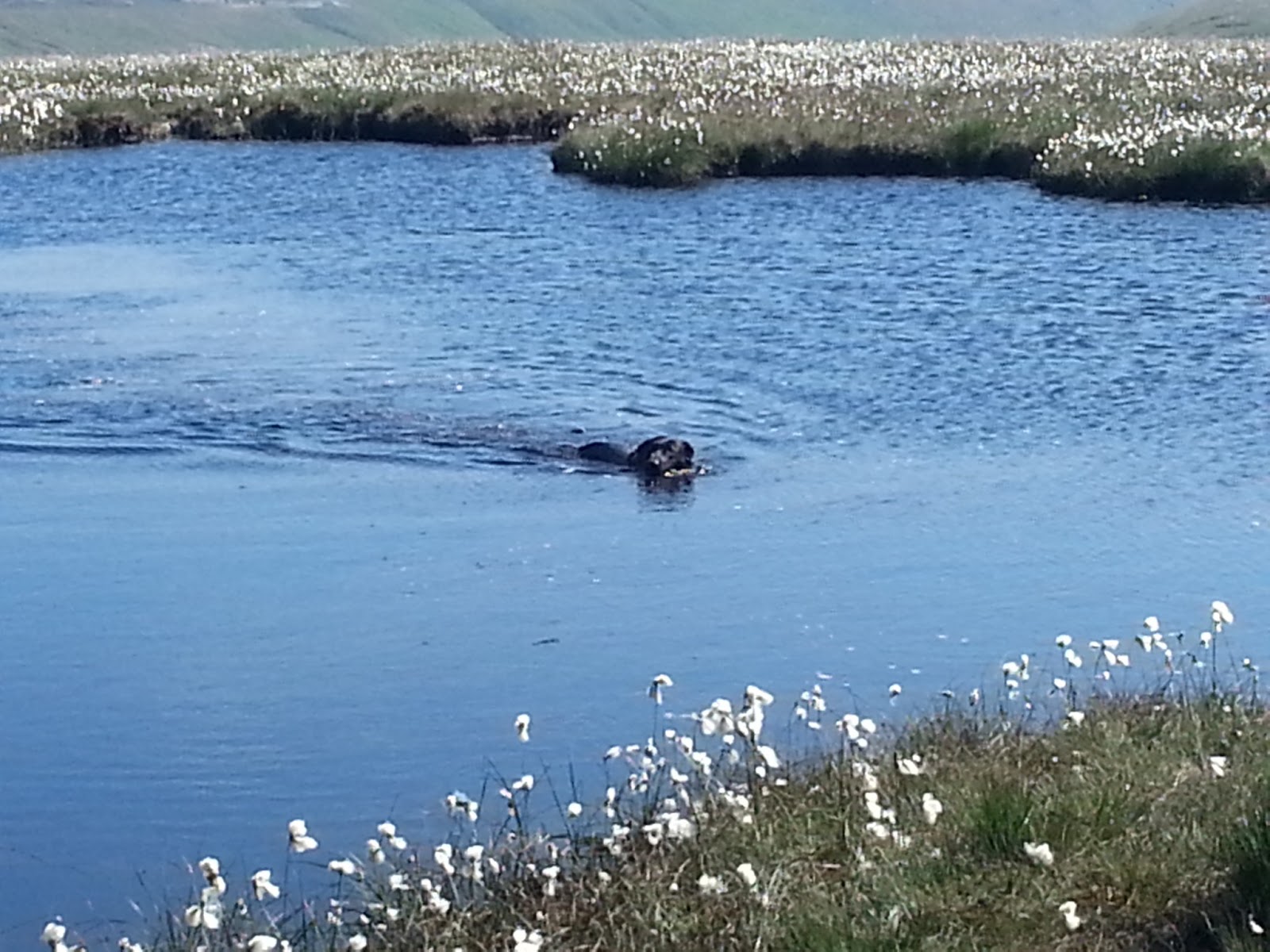
With not much left to go, we got to a steep descent and before we knew it we went back up the steep hill on the other side. we walked along the limestone pavements and climbed some stone steps, among the bog cotton. We passed some more reservoirs in the Marsden Valley. Not long to go!

A long days walk


Sun going down in Marsden Vally


We could see the road and headed towards it. With one mile to go we crossed it and marched along the bridleway, off the Pennine Way, as our B and B was not in Stannadge. The kind man from the B and B came to pick us up in his land rover, but drove off without me! Somehow I found the energy to run after him and yell "No!". He was very apologetic.

After a long day we are all stiff and tired; even Paddy!

Thanks for reading, see you tomorrow on the way to Hebden Bridge.

Caitlin xx

Day 01: A Scorching Start

Day 01: Edale to Crowden 

Today's Miles - 16.1 miles
Today's Ascent - 3162 feet
Today's Descent - 3241 feet
Total miles walked: 16.1 miles

Star team member: Mam for struggling on despite injury (read on ...)


The first day is over! It was tough. It was hard. It was very, very hot. But we made it!

While you have been enjoying your BBQs, relaxing in your gardens, or having a trip to the beach, I have walked through peaty moorland, boggy marshes, and rocky ground. All in the scorching hot sun. I have to say that it was comparable to the Shap day (for those of you that read my entry on my C2C blog), and towards the end I though Mam's legs were going to fall off they were wobbling so much! But, here we go, I will recount it just for you.


The Start

Aunty Jane dropped us off at Edale Station at about nine o'clock. We got ourselves psyched up, raring to go and of course got the group photo taken! We got our packs on and set off, taking our first steps of the Pennine Way. Or so we thought...

We walked along the road for five minuted and then saw the Old Nag's Head pub, with a sign stating the official start of the Pennine Way. Photo opportunity again! So, really starting at the train station was pointless (Dad's idea), but anyway, we plodded on. We walked through typical Derbyshire countryside, lush green fields, rolling hills, and a LOT of sheep. Paddy found his first stick and was very pleased with himself. We were walking around the base of a little hill, and we turned the corner to find a stream that Paddy was more than eager to splash in.

Paddy cooling down


We walked a mile to sign marking the start of Jacobs Ladder. The name states its formation; a steep footpath zig-zagging upwards. Remember that it was very hot, so hard going. We stopped at a cairn for some (melted) chocolate and some precious water, we only had three bottles in the heat, then continued up the ladder. All the while aeroplanes gloatingly passed overhead from Manchester airport, taking passengers to exotic locations for blissful, effortless holidays.

Summit 1: Kinder Low


The path turned right and we reached our first summit of the Pennine Way, Kinder Low. We then walked around to Kinder Downfall and had our lunch, while Paddy had a splash in the water. After our lunch (kindly provided by Jane and Chris; you know who you are!) we walked down a steep path to some crossroads. We got our mileage up on the limestone pavements, and our spirits were high as we were moving quickly and Dad had promised us an ice cream van on the main road, so we were happy. Paddy took every opportunity to jump in boggy slop (sorry Uncle John, your hard work cleaning his shiny coat didn't last long!), this was fine as there was a pond he could go in to get clean after the road. Paddy got out of the slop and shook his mucky coat all over Mam. We reached the main road to find no Ice Cream Van, and the supposed pond had dried up, so we had a mucky dog, and three ice cream-less walkers. :-(

We crossed over Snakes Pass and headed over to another summit (if you, like me, thought the Pennines were flat, then think again!) called Bleaklow Head. It was very peaty and we were running low on water. After an hour and a half's climbing we got to the top, and on the way paddy had found a very large stick and a clean, un-boggy river to wash off the muck. With three miles to go we walked down through the heather, but it was quite rocky and you had to watch your footing. Sherpa Dad and I were walking ahead with Pads leading, and we heard a cry from behind. Mam had fell and had scraped her leg on the rocks. now this was not your usual 'playground fall over scrape', the rock looked like it had gauged her leg out. Look at the picture if you don't believe me!

Rocky Horror Picture


Despite the injury, Mam struggled onwards, but we were understandably walking a bit slower. We went up yet another hill (the Pennines really aren't flat!) and had a break while Mam let her leg rest. e walked along a ridge and started to drop downwards. We could see the farm and the road, but we had a steep descent to make. It felt a bit like we were dropping off the end of the world and our legs were shaking lots. Mam had to put the knee braces on, as hers were wobbling everywhere. We got to the farm at the bottom and there was a sign with our B and B saying "600 yards after the left turn on the road". It was tantalizingly close, and after coming off the edge of the world our legs and feet were aching. We started hallucinating, thinking every bit of wood was our B and B. We turned the corner and there it was;a sight for sore feet! We had made it!

Not far to go


Thank you for reading this post, I hope you enjoyed it. Fell free to leave messages or send me a text or e-mail; it really makes all the difference!

Caitlin :-)